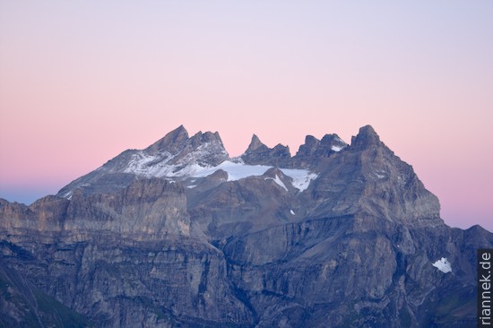
Directly north of Martigny, the Rhone Valley cuts through the Morcles nappe, where some of the most beautiful folds in the Alps can be seen. Reason enough to complete the Tour du Mont Blanc with a hike on the Dents de Morcles to see some more geology: in 3 days from the Dorenaz cable car via Portail de Fully, Demècre, La Tourche, Pont de Nant, Anzeinde to Derborance. (Description with maps and geological sketches at ViaGeoAlpina.)
In addition to the exciting geology, I am accompanied by great views of the Mont Blanc Massif, on Grand Combin, the peaks of the Dents du Midi, Lake Geneva and, at the very end (at Pas de Cheville), the Matterhorn, Dent Blanche and Weisshorn.
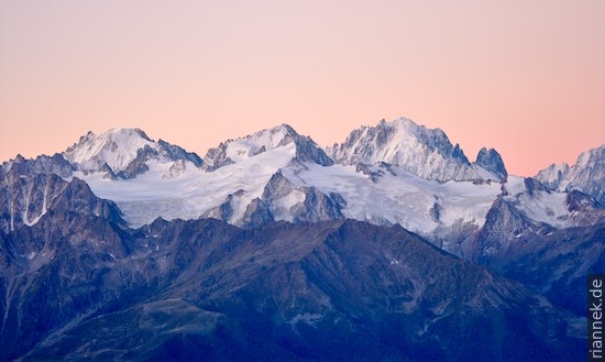
Aiguille d’Argentinière, Aiguille du Chardonnet, Aiguille Verte (back), Aiguille du Tour (front)
Like the Helvetic nappes, the Morcles nappe consists of sediments deposited on the European continental margin (mainly Jurassic and Cretaceous limestones). However, it is usually counted as part of the parautochthon (i.e. the almost unmoved sedimentary layers resting on the basement) because, unlike the far travelled Helvetic nappes, it has only travelled a short distance. The front of the nappe was folded downwards, so that the entire nappe is a huge recumbent fold. This fold is so large that you have to hike a bit to see every part of it. The layers within the folds are in turn laid out in countless smaller folds.
On the Dents du Midi on the opposite side of the Rhône valley, the whole structure is visible in one piece, the bend of the large frontal fold can be seen on the Cime de l’Est, smaller folds inside the large fold can be seen on the adjoining mountains to the south such as Gagnerie and Tour Sallière.
From Demècre, only the lower limb of the fold is visible at the peaks of the Dents de Morcles, whose sedimentary stack is upside down; the upper limb is eroded away here. In the Cretaceous limestone of the Petit Dent de Morcles is one of the most beautiful smaller folds.
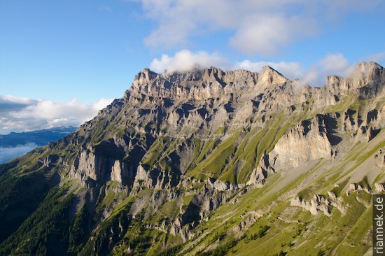
Under this limb of the Morcles nappe is flysch (the sediments of Tertiary turbidity currents deposited while the Alps started to rise, the upper part is still counted as part of the Morcles nappe), in the lower part the soft rock is a steep grassy slope that the hiking trail follows. The light-coloured rock face below (Malm limestone) belongs to the sediments that still lie on top of the bedrock (e.g. the Portail de Fully is dolomite (“Rauhwacke”) from the Triassic, directly below is the basement).
From the Col des Perris Blancs, more of the Morcles fold is visible: not only the Cretaceous (the outer shell of the fold, so to speak), but also the Jurassic limestones (the core, so to speak). The Jurassic limestones of the lower limb curve upwards at the Muveran, the upper limb of the Cretacious is only preserved on the mountains that are in the second row here. L’Argentine, the small mountain north of the Grand Muveran, is the front of the Morcles nappe: the vertical north face of this mountain correspond to the fold hinge of the Cretacous limestones. On the Diablerets, still further north, other folds can be seen, but these are the Helvetic Diablerets nappe, which has thrust over the Morcles nappe. Between the two nappes (Anzeinde plain) is another nappe (Ultrahelvetic, from a deeper marine area of the European continental margin). As the entire nappe stack dips to the northeast, the upper limb of the Morcles nappe is also completely preserved with Cretacous limestones in the mountains south of Anzeinde.
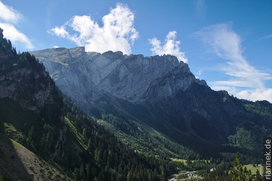
Finally, at Pas de Cheville, one looks into the Derborance basin, where the Morcles nappe plunges under the Diablerets nappe. On Mont Gond on the opposite side, the lower rocks belong to the Diablerets nappe, but the folds at the summit already belong to an even higher Helvetic nappe, the Wildhorn nappe.
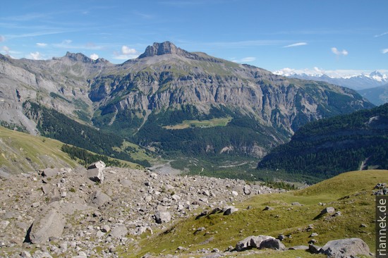
The entire basin is filled with the masses of two large landslides that broke loose at the Tête de Barme in 1714 and 1749 and dammed up the lake.
Read on
The Formation of Mountains
Tour du Mont Blanc
From Kandersteg to Grindelwald: Trekking in the Bernese Oberland
Glarus Thrust and Bregaglia Granite